In 1769, a sanctuary was erected to the north of Nicoya, around which grew a village that received the name of Guanacaste (present-day Liberia), due to the abundance of said tree in the area, where travelers coming from Nicaragua to Nicoya stopped to rest.
Guanacaste was initially part of the territory of the former Nicoya Party during colonial times, this region of Mesoamerica was not part of the four territorial units of Central America: Guatemala, which included Chiapas and part of El Salvador, San Salvador, Comayagua, Honduras and Nicaragua-Costa Rica.
After the independence of these territories, each one more or less coupled to its current form shortly before 1821, however, the fate of the area of the former pre-colonial areas of “Nicoya”, that is, of the Guanacaste territories, that remained undefined. Beyond Tempisque, a town that did not belong to Nicaragua decided on its own and sovereign will to claim annexation to the nascent republic of Costa Rica on July 25, 1824, later becoming province number 5 of the nation after a territorial organization of this strip, located in the extreme northwest of the country, with the name of Moraica district for a very short time, then it was renamed Guanacaste by decision of its inhabitants in 1860 in honor of the Costa Rican national tree that bears the same name and identifies this region of the Pacific.
This northern province of Costa Rica is bordered to the north by the Republic of Nicaragua, to the east by the Province of Alajuela, to the south by the Province of Puntarenas, and to the west by the Pacific Ocean. It has an area of 10140 km². It is the second largest province in the region, however, it is the most uninhabited, with an approximate population of 400,000 inhabitants, with 11 cantons and 61 districts. Its head is Liberia, located 210 kilometers from San José. Other important cities are Nicoya, Santa Cruz, Cañas.
Its topography combines the volcanic peaks of the Guanacaste mountain range with wide plains that open towards the Pacific. The main geographical features are the Santa Elena peninsula to the northwest, the Nicoya peninsula to the southeast, which is the largest in the country and encompasses the Gulf of Nicoya. At the center is the tectonic depression of the Tempisque Valley. It has large expanses of plain, which makes it a suitable land for raising cattle and growing grains, especially those formed by the Tempisque river valley, which is why the province is nicknamed “la pampa” and also “the lowland”.

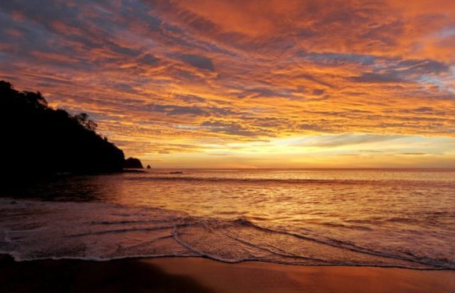
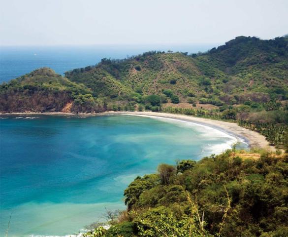
Guanacaste is famous for its beautiful landscapes, its beaches that border the Pacific Ocean coast, and a much sunnier and drier climate than in the rest of the country, positioning itself as one of the tourist attractions with the largest natural reserves in the nation.
Territorial disputes
Costa Rica on certain occasions has had territorial disputes with its neighboring country Nicaragua over the province of Guanacaste, this is because Nicaragua on several occasions has considered that this territory historically belonged to the geographic unit of Nicaragua-Costa Rica, which has not always been the case. It was an autonomous space located in the region of El Partido Nicoya, which decided to voluntarily annex to the southern region, the nascent Republic of Costa Rica due to its geographical, cultural and economic similarities, after having achieved its independence and territorial separation from the unity of Nicaragua.

However, these two Central American sister nations still present border controversies for the use and environmental conservation of the San Juan River, which is a natural water resource of common use for the two countries.
Fluvial border delimitation
Costa Rica and Nicaragua share the largest hydrographic basin in Central America which corresponds to the San Juan River. The lower section of said river constitutes the border between the two countries, as established by the 1858 Cañas-Jerez Boundary Treaty. Unlike other borders, the fluvial border delimitation of this treaty was influenced by the pressures exerted by the United States and England, who at that time disputed control over the projected interoceanic canal that ran through that territory of the Central American isthmus, and made the appropriate diplomatic efforts so that said border was as favorable as possible to their interests. Since the canal was not built, this has contributed, together with other factors that the San Juan River is the object of successive conflicts between the two countries.
The two centuries of relations between both countries as independent States have been marked by the confrontation regarding the fluvial border delimitation of the San Juan River, as well as the navigation rights and environmental protection of the territory, which has motivated them to resort on various occasions to international courts for its resolution, the last ones corresponding to the judgments of the International Court of Justice of July 13, 2009 “Cause relative to the dispute over rights of navigation and related rights (Costa Rica v. Nicaragua)”.
Another was on December 16th, 2015 on the matters “Certain activities carried out by Nicaragua in the border region (Costa Rica v. Nicaragua)” and “Construction of a highway by Costa Rica along the San Juan river (Nicaragua v. Costa Rica)”; and February 2nd, 2018 “Land border in the northern part of Isla Portillos (Costa Rica v. Nicaragua)” have been one of the most recent border conflicts that have arisen between the governments of these two Latin American countries with the presence of great environmental wealth.

