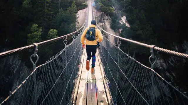
With 30% of its territory protected by national parks and natural reserves, Costa Rica is a country that offers multiple natural landscapes where exploring them is best experienced on foot. Its trails in tropical forests, cloud forests, mangroves, beaches, mountains stand out, as well as delimited trails and some more virgin for the more adventurous.
Hiking is one of the most popular recreational sports practices for both national and foreign tourists. The country is poised to attract tourists from around the world, in part thanks to tourism agencies that offer affordable and accessible travel packages for the entire population.
Are you passionate about hiking?
If you want to know which are the best places to go hiking, when to do it and all the necessary details, here is a complete guide:
1) Cerro de la Muerte
Summer is the best time to visit the Iyok Ami agrotourism farm, located on Cerro Buenavista or commonly known as Cerro de la Muerte for hiking and observing the mystical Quetzal. Located at kilometer 71 of the south interamerican highway, this reserve in the páramo cloud forest has the ideal qualities that the mystical bird requires for its courtship, mating and nesting. The Cerro de la Muerte also has a significant number of native avocado trees, whose fruit is the main source of food for these animals and which attracts them to the area.
2) Cerro Chirripó
Located along the heart of the Cordillera de Talamanca in the south central part of Costa Rica, is the Chirripó national park that consists of more than 50 thousand hectares. Hiking tours will allow you to reach the highest point in the country and the second highest in Central America.
The top of Cerro Chirripó is 3820 meters. On a clear day you can see both the Pacific Ocean and the Caribbean Sea at the same time. Typically, the entire journey takes adventurers two or three days to complete.
To get to the park from the capital city, head east through Cartago on the Pan-american highway, eventually, the main road climbs up to Cerro de la Muerte and then it will be reaching San Isidro de El General, then continue to San Gerardo de Rivas.
3) Corcovado National Park
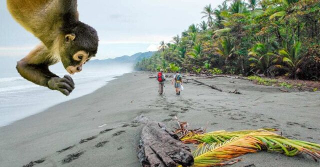
The Corcovado National Park in Costa Rica is located in the southwest of the country, with access to the Pacific Ocean. 2.5% of the world’s biodiversity is found in this area, according to the national system of conservation areas.
In addition, there are 140 species of mammals, which represents 10% of the American continent. Tourists no longer require guides for excursions or hiking to some of the trails in Corcovado national park.
The national geographic magazine, discovery channel and the Spanish newspaper, el país, classified Corcovado among the best destinations in the world for its remote location, intense biodiversity and extraordinary adventure.
4) Cruz de Alajuelita and Cerro Cedral
To do a good hiking practice, you do not have to leave the greater metropolitan area and that is what you can get by doing the “breastsbreaker”, a hiking route in Alajuelita on Cerro San Miguel.
You will walk along the Agres river and then a climb of almost a kilometer and a half at an angle of 45 degrees on the San Miguel hill, so that the chest is almost hitting the hill and a lot of effort is required, that until climbing to the Cruz de Alajuelita and then take a break and begin the descent through another sector.
Cerro San Miguel is the fourth highest in Escazú and reaches an altitude of 2,035 meters above sea level. If the weather conditions allow it, you will be able to observe beautiful views of the central valley and the Rabo de Mico, Cedral, Pico Blanco and Pico Alto hills.
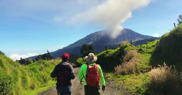
5) Miravalles National Park
Miravalles is located in the province of Guanacaste and was declared a national park in 2019, becoming number 29 in Costa Rica. It has an area of 4,300 hectares. To get there, you must first go to Bagaces, which is located 194 kilometers northwest of San José, on the Pan-American Highway, then continue towards Guayabo, 30 kilometers north of Bagaces.
At the Guayabo-La Fortuna crossing, the Miravalles volcano looks imposing. The humid and very humid forest covers its skirts. It is the refuge of some felines, deer, coyotes, tepezcuintles, saínos and white-faced monkeys, among many others.
6) Cloud Forest Reserve Monteverde
The Monteverde cloud forest biological reserve spans around 5,000 hectares and is world famous for its cloud forest. More than 2,500 species of plants, 100 types of mammals, 400 different birds, and 120 reptiles and amphibians provide extremely high biodiversity.
Monteverde was included in the world ranking of the most remarkable forests in the world, so it is undoubtedly a spectacular place to go hiking. To get to the reserve, follow the inter-american highway north from San José to km 149.
Just before crossing the bridge over the Lagarto river, turn right and continue for 40 km on the gravel road. Also, there are direct bus services from San josé to monteverde and taxi service between santa elena and the reserve.
7) Paquera-Curú national wildlife refuge
The 17 trails that cross the Curú national wildlife refuge, in the Gulf of Nicoya, have a special ingredient that will attract hikers; it is Playa Quesera, chosen as the “best beach” in Costa Rica according to the ranking made by Goplaya, the first search engine for these sites in the country.
To get to playa quesera, you will have to walk about 6 kilometers to find this white sand beach, perfect for snorkeling. The area has a great variety of flora and fauna, where specialists have identified 78 species of mammals, 87 species of reptiles, 232 different types of birds and more than 500 species of plants.
In this natural sanctuary you will find 3,705 hectares of tropical forests, mangroves and green fields along the coast. Drive to Puntarenas (2 to 3 hours depending on traffic), take the ferry to Paquera (1 to 1 1/2 hours) and drive to the entrance of Curú (30 minutes). The entrance will be on the left side.
8) Sarchí
The Else Kientzler garden is located in Sarchí, the cradle of national crafts and the place where the picturesque typical wagons are made. They have seven hectares of exuberant tropical gardens that have been designed in an attractive way for the visitor, having a garden of hibiscus, heliconias, succulents, bromeliads, palm trees, orchids, fruit trees, grove, among others. A tour of the trails and gardens takes about an hour and a half and can be entered with pets.
9) Carara National Park
The Carara national park, located between the Cerros de Turrubares and the canton of Garabito. The main entrance is 2 kilometers south of the Rio Grande de Tárcoles Bridge.
The Carara national park, which in the Huetar indigenous language means “river of lizards”, has the only transitional forest in the central pacific, which translates into diversity of flora and fauna, where dry and humid forest species converge.
This national park is a world-renowned ornithological destination because it has a very diverse bird fauna, where the red macaw (aramacao), a species in danger of extinction, stands out. It is the first national park that has a universal access road, where the visitor can enjoy the experience of hiking inside the forest, meeting endemic species and large trees.
10) Turrialba Volcano
This protected area is located in the canton of Turrialba in the province of Cartago, at the easternmost part of the Central Volcanic mountain range, 24 kilometers northwest of the town of Turrialba.
The Turrialba volcano forms a single system together with the Irazú volcano. It is an oval-shaped stratovolcano and its formation is due to explosive and effusive lava events, it has three craters with the presence of flows on its flanks. It has a maximum elevation of 3,340 meters above sea level, being the second highest volcano in the country
