Costa Rica is a country rich in biodiversity and therefore also in geography, which is important to know very well when making a hiking plan and, in the case of those who write and narrate news, so that they do not make mistakes in the different data.
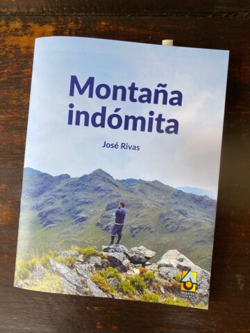
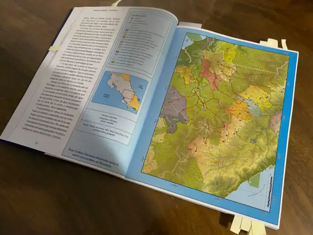
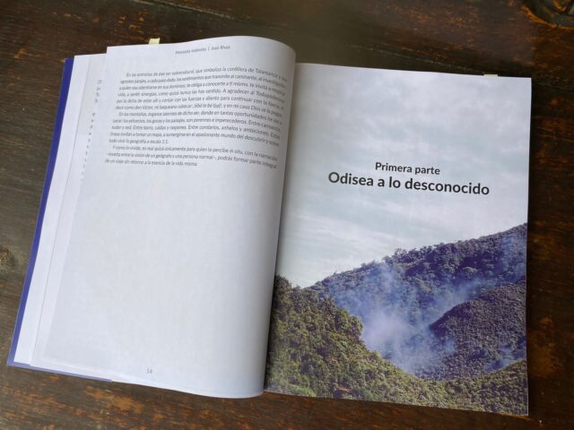
All of the above has been emphasized for many years by the Costa Rican geographer, José Rivas, who already has a book, the first of many to come, “Montaña Indómita”, as he called it.
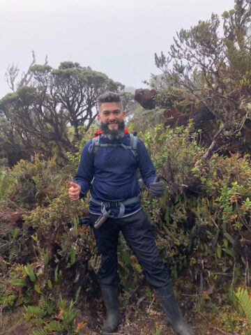
He studied at the University of Costa Rica and until today, he has dedicated himself to writing and where? He has a Facebook profile, in which he has tried to venture into the field because, in his opinion, he has always noticed serious deficiencies regarding the geographical location, geographical names, and the information that is generated in the various media and social networks, “which generates confusion”.
He has a personal Facebook profile and one that is called Montaña Adentro, “there was already a Chilean writing that was called that way, I tried to register it, but it turns out that it was already there and I decided to call the book Montaña Indómita, it has to do with Talamanca. Many of the texts have been there, for the book I gave it more of a narrative form. My book can be a reference book, made from the heart, to teaching correctly and reliably about the geography of Costa Rica”.
He started writing as a hobby, “I have always been writing some things related to geography, then one day it occurred to me to make a book, it is a somewhat complicated issue because it takes funding and support, and not always one finds it, as they say -no one is a prophet in his land- then sit down and write a book with a specific theme is difficult, but as I already had written material for several years, I turned it all into a book,” he said.
The intention or idea of the book was more or less a year ago, exactly in the process of recovery from an accident he had in June last year. It turns out that he had an encounter with a swarm of Africanized bees on a work tour in Upala, canton number 13 of the province of Alajuela; the bees completely covered his body, Rivas was walking through a rural area, he spent about two hours under the bees, which stung him of course, he told us that he had already lost hope, because he shouted Help, Help! until a person, Don Juan, rescued him, “I do not know how only God knows. I don’t know how only God knows. Don Juan was a farm hand from a nearby farm, I owe my life to him. They took me to the hospital where I was for a month, and then I was in recovery, I was on dialysis because it affected my kidneys, when you go through a situation like that you want to do a lot, so I started to analyze that it was time to write something. I started to write about the tours I made to Talamanca, both to the center of the Caribbean and from the Caribbean to the Pacific. A couple of years ago I came up with the idea, but I already had it, I contacted a publishing house: Editorial del Norte, and Mr. Fabio Rojas Carvallo helped me, so today the book is already a reality”.
What led you to write the book, what was your inspiration?
During the time that José Rivas has been working as a geographer since 2004, he has been working in the field, for him, the field is the geographer’s laboratory.
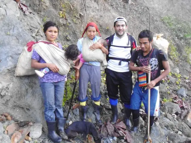
He also told us that, from the beginning, he had to move to a remote village in Costa Rica because the project he was working on with ICE required it. He assured that many are places of difficult access, isolated houses, especially in indigenous territories, for example, one of them is the canton of Talamanca, “in my experience what I did was to capture or mention to the people that those places still existed, although now we are in times of technology and information, there are places like these that have no electricity, water, where living conditions are very different by the issue of services, they are very remote, so the inspiration is in itself the concept of these distant places and Talamanca, that in maps has been seen to have served as an orographic barrier as we say in geography, to separate what are the Pacific-Caribbean slopes, that step was made by the Indians long ago, many people did it at the time, I am not the first, nor the last to do it, nor do I consider myself the best mountaineer, there are people with more experience than me, but by writing it I wanted to give an idea of what it is from the point of view of a geographer, how is walking through these mountains the name of hills, rivers, rocks and villages”.
Why the name “Montaña Indómita”?
For the Costa Rican geographer, Talamanca has always been a place that is seen from the indomitable point of view, “because since the Spaniards were here in times of colonization, there has always been a resistance from the indigenous people that make up the great Talamanca, that idea that they always resisted colonization, cultural and religious impositions, made Talamanca have that concept, it was never dominated and that feeling remains,” he said.
Talamanca is one of the most mountainous places in the country, where different indigenous peoples converge, among them the Cabecar, and Bribri, among others. Considered “indomitable” because they wanted to extract resources, in incursions to see if there was gold for example, hydrocarbons, or for oil exploitation at the time and all the natural resources that there were, the wealth: water, trees (the wood that can be extracted), but its population has always had that resistance that characterizes it “I hope it stays that way because it represents wealth not only economically, also culturally by the convergence of Indigenous peoples and the contributions that later gave the Spanish and Afro-Caribbean peoples”.
Who wrote the prologue?
The book “Montaña Indómita” has a prologue written by José Eduardo Bedoya Benítez, former professor of cartography at Rivas, who was director of the National Geographic Institute from 1996 to 2004, “I talked to him and asked him if he could help me with it, I gave him the manuscript to read, we agreed on many of the criteria, he made good corrections because I wanted him to make corrections from the geographical point of view, for me it was an honor to tell him and that he agreed to do the prologue”. Don José Bedoya is a member of the National Commission of Nomenclature, which is the one that registers and watches over the correct geographical names of the country, he is also a member of the Costa Rican Academy of Geography and History.
Regarding the collaborators of the book, Don José was one of the collaborators, a teacher from Rivas, named Zinnia Corrales and Don Fabio Rojas Carvallo, a very interesting and meticulous work team-.
The cover photo
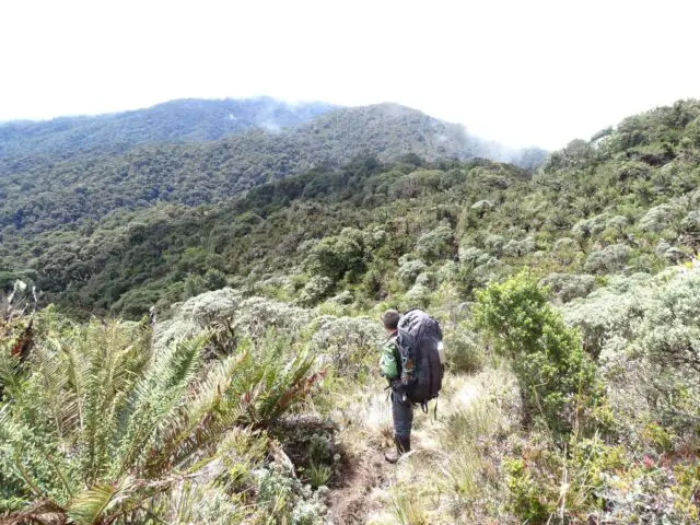
The cover photo is on the northern flank of Cerro Chirripó, José explains that, when one climbs it, which is the highest point in the country, it is 3,820 meters above sea level, “What you can see on the map is the Chirripó National Park and in the background, you can see the northern row or also as it is usually called the mother row, indeed the one in the photo is me”.
What will the public find when reading the book?
The passionate geographer wants to show a point of view that is not widespread, that of a geographer, of a person who analyzes geography, who sees from the top of a hill what is beyond, who knows with a map in hand what is out there and who wants to guide with the narration to a person who reads the book step by step, how was the process of reaching the goal, how was the day by day overcoming the obstacles to reach a point.
In this journey there are not days, there are weeks and it is always necessary to have previous preparation. There is something very important in the development of the work of a geographer, who cannot present the field without knowing it, living it, or touching it, so the writer now has the desire that the reader is immersed in that walk, “to walk with me and be surprised as I am of all the wonders, What it is to cross the river with the water in your chest, what it is to get wet, to build a camping tent, I never carried a camping tent, I carried one of those black plastic ones for nurseries and what I did was to stick several stakes in the ground and make a roof, so that I could easily roll it up and take it with me; What I wanted was to expose that experience and tell people that these places still exist in the country even though we are in this century,” he emphasized.
Places in Costa Rica that have a mystery, magic, something special that everyone should know?
Referring to the places in Costa Rica that, in his opinion, everyone should know because of how incredible they are, he mentioned: La Amistad International Park, “going through the official trails that exist, they give you that idea of what is the most elemental Costa Rica, more pristine. I like the word pristine, because the waters that emanate from there, enrich practically the whole country, give us a lot of resources, and make the green Costa Rica that we have tried to promote for many years a reality, much of that has to be preserved, I am of the idea that there are places that should be preserved with great respect, I am of the idea that there are places that should be preserved with much respect, also to the Indigenous peoples and all the culture they represent, many times when you go to these places you feel things that you would not feel in others, there is a unique contact with nature, sometimes the silence invades you, in others, the noise of the birds, the trees too”.
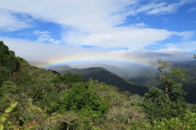
Another of the places that Rivas named and defined is the Kamuk hill, “It has its mystery, its magic, reaching three hills with the hospitality of the people makes you feel special and when you walk until you reach the goal, it is incredible the silence, the fog. Another place is the Corcovado National Park, which keeps the magic and richness of the tropical forests, with more than 500 species of trees, where you can observe animals such as felines, and tapirs, among other animals”.
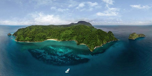
And, he mentioned Cocos Island, a National Park that was declared a World Heritage Site by UNESCO in 1997 and a Historic Architectural Heritage Site by the Costa Rican government in 2002.
Visualization of the future of the geographer and writer
José Rivas expressed that, having ventured into the world of writing has pleased him a lot because perhaps these are things that he does not develop so often. For him, it is not so much the interest of becoming famous or a millionaire, it is to be able to impart knowledge, to teach, so that people can have reliable sources of data, truthful and reliable information. “I’m interested that, if someone reads me, they will become more educated”.
He would like to teach at some point and finish his master’s degree in geography.

If you visit other countries, how would you define Costa Rica?
For him, Costa Rica is a convergence of geographical, cultural, and social factors that have made the country have a good presentation card, there may be problems as in any nation, -but within everything, we must always take the positive to make life better-.
“For example, if you stand on a hill and begin to see in your environment that you know, your geographical space makes you have a better vision of the country, and that makes you have a better vision of the world, what do I mean by this, that we must know Costa Rica better, learn more about the country and then go further. Geography should be a science that is taught in schools, that is developed beyond the few subjects of study. Geography should be given more value” he added.
If you had to recover any place or work in Costa Rica, what would it be and why?
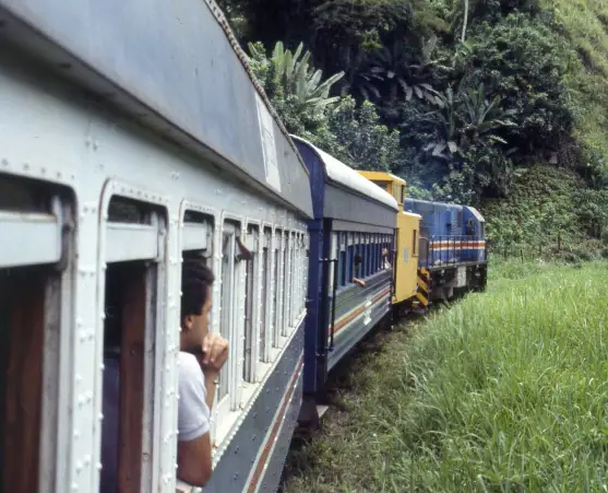
The geographer Rivas would like to see the return of the Caribbean Railroad, “I know there are limitations, it is a pity that during the government of José María Figueres, the decision was made to remove it. Developed countries have a railroad system, we don’t, what we did was go backward in my opinion, and if it can be recovered it would be phenomenal, not only for the economic part but also for tourism. I remember that when I lived in El Limón, twice I had the privilege of passing by the railroad and they had a very authentic culture, you passed by very beautiful places, the people stayed there selling things, the society moved in general, you never saw that again”, he said.
Finally, José Rivas, shared a message for everyone, “enjoy, live, and feel geography every day, it is a one-to-one scale, that allows you to visualize your immediate environment if you are in a mountain, you will observe that there are many things: the slopes, the vegetation, the fauna, the people, all that accumulation of things makes you enrich yourself if you do not know those places, but you observe a map and locate, you can reach the summit, which will become small because you will see others, then the geographic knowledge will expand and what I want is, that people have that expansion, with official sources of information, that they write correctly the data so that this geography can be transmitted. We are going to make our society a little better, knowing our environment, and going from the micro to the macro. When I write I do it to enrich others, because if I wrote only for myself it would be meaningless, knowledge will always be important”.
For us, is valuable every word of the Costa Rican geographer who, undoubtedly, has dedicated himself to studying and informing beyond the wonders that Costa Rica has as biodiversity, we wish him the best of success!.
If you want to know more about José Rivas, you can find him on his Facebook profiles: Geographer José Rivas and Montaña Adentro; He also has a blog: https://montanaadentro.blogspot.com/.
