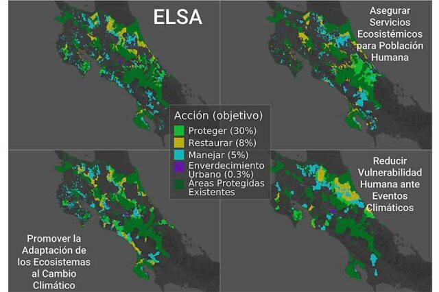
Costa Rica appears today as a pioneer in the use of the Essential Life Support Areas (ELSA) methodology, even at the international level, under a specific focus on adaptation to climate change.

The Ministry of Environment and Energy (Minae) highlighted that Costa Rica is making progress in the development of national maps that identify the main areas to be protected, restored and / or sustainably managed in the territory.

The foregoing, he argued, to increase the resilience of people and nature to the threat of climate change for basic ecosystem services of life and economic activities in the country. He revealed that this initiative belongs to the Mapping of Nature for People and the Planet project, in an alliance between Minae and the United Nations Development Program (UNDP).
The holder of that portfolio Andrea Meza affirmed that climate change is one of the greatest threats to life and the economy of Costa Rica. He pointed out that the most recent report of the Intergovernmental Panel on Climate Change is conclusive: “there are changes that are already irreversible and to which we have to adapt. We need to address this problem from several fronts, and a fundamental one is from nature itself.”
Ecosystems and climate change
Ecosystems can help us to face climate change, knowing where we have to act and what we should do is a great step for the country and it is something that we must reflect in the new National Plan for Adaptation to Climate Change, the Minister considered.
During the presentation of the initiative, they pointed out that the ELSA identification methodology was developed by UNDP and the University of Northern British Columbia in Canada and has been implemented in Costa Rica with the leadership of Minae and the PRIAS Laboratory of the National High Technology Center.
National priorities
In this regard, the UNDP Costa Rica resident representative, José Vicente Troya, expressed his agency’s pleasure in supporting Costa Rica’s efforts with pioneering initiatives that contribute to resilience in the face of the climate crisis and the creation of conditions for conservation. This geospatial analysis will help identify national priorities and actions to be taken to reduce losses and ensure ecosystem services such as water, said Troya.

The director of the National Center for Geoenvironmental Information of Minae, Rafael Monge, specified that this is the first time that the ELSA methodology has been used, even at an international level, under a specific focus on adaptation to climate change.
Official data reflect that the costs of repair and reconstruction due to weather events in the next five years could represent up to 2.5 percent of the Gross Domestic Product of this country.

