Costa Rica captivates with its beaches bordered by tropical vegetation, which surround it to the east (Caribbean Sea) and the west (Pacific Ocean). But another of its best tourist destinations is the imposing volcanoes that form the backbone of its central spine; in fact, 5 out of them are active and, thanks to the clouds that swirl on their slopes and the ash they expel, they help maintain the fertility of the land and the magnificent mountain forests that cover the country.
42 years of intense activity
Cerro Arenal, which had been asleep for more than 4 centuries, had suddenly woken up. Its violent eruption caused at least 87 deaths and the loss of some 45,000 heads of cattle. A couple of days later, a burning cloud killed 8 people who came in 2 vehicles to help. Since then, the Arenal is one of the most active volcanoes in Costa Rica. Until 2010, every night you could see the lava pouring down the slope. When that tragic day happened, Arenal was a 1,670-meter cone that could not compete in activity or height with the great volcanoes of the Central Cordillera closest to the capital: Poás, Irazú, and Turrialba. On a map, we see that these 3 giants can be joined with a straight line. If we extend that line to the north, it connects directly with Arenal and then with the volcanoes of Santa María and Rincón de la Vieja, which are also active.
The 3 main plates in a row of those volcanoes
On his tour of South America, at the beginning of the 19th century, the great explorer and geographer Alexander Von Humboldt wondered for what strange reason the craters of volcanoes seemed to play tic-tac-toe. A century later, Alfred Wegener stated that the continents move like icebergs over the sea. Today we know that Wegener’s theory was true: the Earth’s crust is fragmented into large plates and along these fissures, earthquakes take place or lava emerges from the depths. Between the fissures, the ocean floor slides like those conveyor belts at airports and with its movement drags the continents, which move away or come closer to each other, the Pacific coast of Central America coincides with one of those great underwater cracks. There, the Cocos plate pushing east meets the Caribbean plate and embeds itself beneath it. In this active fissure, the great volcanoes of Costa Rica sprouted, forming the backbone of the territory.
Small farms in the tropics
At the foot of these peaks, which still gently smoke, is San José, the capital of the country, on a plateau with a very mild climate. The pleasant temperatures (minimum of 15ºC and maximum of 26ºC) and the regular rains (just over 1 thousand liters per year) are a privilege in the tropics. Added to this is the fertilizing power of volcanic ashes, rich in potash and other mineral salts, which are hot and humid areas that act like fertilizer from the sky. In the 19th century, when the economic potential of coffee cultivation was glimpsed, free land and seeds were offered to peasants. With this, the central plateau gradually became that mosaic of small farms that can still be seen today. Today, crops have diversified, but what is most remarkable is that most farmers own and live on their land.
An agricultural orchard
As soon as you leave the airport, the large black nets that shade the tropical flower crops, such as orchids, heliconias, and the bird of paradise flower, attract attention. Mango, papaya, strawberry, granadilla, pejibaye, sapote, and anona –a variety of custard apples– are some of the fruits of Eden in Costa Rica. Rice, red beans, and raw cabbage in a salad are not often missing from any meal and are grown in abundance. Holstein cows, with black and white fur, or orange Jersey cows, graze on the green slopes of the Irazú and Barva volcanoes, thus giving the landscape a misleadingly Swiss appearance. More unusual are the butterfly farms, whose larvae are exported to the West. Other times, butterflies can be admired under enormous mesh domes, as in the gardens of La Paz Waterfall.
The stepped craters of Irazú

In March 1963, coinciding with the visit of President John F. Kennedy, the Irazú volcano (3,432 meters) had its last major eruption, which lasted for 2 years and covered the central plateau with a generous layer of ash. The villagers used to walk with umbrellas to protect themselves from that persistent mineral rain. Around 300 homes collapsed due to the accumulated weight on their roofs. The Reventazón River, which drains the plateau towards the Caribbean, overflowed its banks several times due to the copious amounts of sediment. Irazú, the largest volcano in Costa Rica, now only has active fumaroles and a bus drops off passengers a short distance from the summit. It has 3 stepped craters; 2 of them occupied by beautiful lagoons. On a clear day, from its top, you can see the 2 oceans that bathe the country. But that usually only happens in the dry season. The rest of the time, the Irazú offers a cold and windy top through which the clouds parade.
The rejuvenated Turrialba

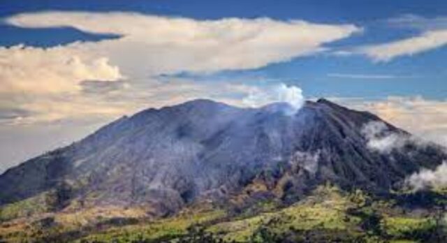
Neighboring Turrialba (3,329 meters) seems to be so named because of the white plume that often crowns it (“Torre alba”). Its last major eruption was in 1866, which was followed by a long period of calm. But, as of 2003, its activity increased notably and in recent years it is common for it to spew clouds of gas and even ash. To access its summit, it is necessary to use an off-road vehicle or make a long excursion.
The Poás caldera
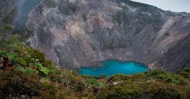
The Poás crater (2,704 meters) is the most visited in all of Costa Rica. A paved road climbs almost to the very top. From there, a short walk to a lookout overlooks a huge caldera that houses a bubbling, milky-turquoise lake. Sulfur vapors set the scene. It is not allowed to go down to the lake, as sometimes toxic gases surround it. In the wet season, from May to November, it is better to go early, as the clouds increase as the afternoon downpour sets in. Nearby, it is a secondary crater occupied by Lake Botos, a beautiful emerald green. The trail runs along the misty ridges and allows you to discover hummingbirds sipping nectar from jungle flowers.
Waiting for the end of the world in the Tabacón River
To contemplate the slender Arenal, it is enough to have a room with a view of the village of Fortuna, a short distance from the cone, and sit at night on the terrace or in the middle of the street. The waters of the Tabacón River, which surprised the boy José Rafael on that tragic morning, continue to run hot. By the way, a resort with a luxury spa (Tabacón Hot Springs) and other more austere ones, allow you to enjoy its waterfalls and pools among the gray basalt, amid luxuriant vegetation. The water is so hot that only when the first impression is overcome is it possible to indulge in such an experience. Relaxed inside that thermal river, all worries dissipate. Although who knows: what if the water gradually increased in temperature without us realizing it in time?
Between purgatory and paradise
The volcano that sowed death, almost 4 decades ago, is now a source of wealth and a focus of attraction. And so it also happens with their brothers from the Central Cordillera. They capture the water from the clouds, which become entangled in their stone curtains, and revitalize the ground with their ashes, creating an extraordinary landscape. It can be seen as a paradise or as a place where you can earn your bread by the sweat of your brow, although it is often both at the same time; “Pura Vida”, as Costa Ricans always like to say.

For those who have experienced shifts in consciousness and know that more peace, joy, and love awaits in a better living environment. A bold shared vision. A living community and hub for innovation. A sustainable ecosystem for living and working. A model for the new future.
