La Amistad International Park (PILA) is located in the Cordillera de Talamanca, about 280 kilometers (km) from San José, the capital of Costa Rica; it covers part of the national territory and continues south to the east of the Republic of Panama. It was declared a Biosphere Reserve by Unesco in 1982 and the World Heritage Site of Humanity in 1983, due to the great importance and diversity of ecosystems it protects.

This international park has an area of 199,147 hectares (Has.) in Costa Rica and 207,000 hectares. In Panama, which gives it the unique condition of being a binational protected area, hence the origin of its name “International” Park. Also “La Amistad” is due to the union of two neighboring nations: the Costa Ricans and Panamanians, who work together to conserve the biodiversity and natural resources of the Talamanca Mountain Range. Although this national park is located in different countries, important efforts are made to give this biosphere reserve integral management.
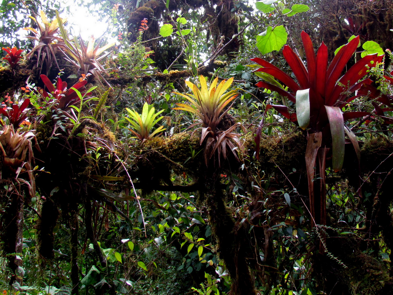
Thanks to its rainfall, temperatures, height, and soils, it has a large number of habitats and provides a refuge for endemic species, being the protected area with the greatest biodiversity in Costa Rica. A main feature that makes this international park attractive is the fact that the visitor can be in direct contact with an unaltered, pure natural environment, where biological diversity is manifested in all its forms, considering this protected area as one of the regions with greater genetic biodiversity, species, and ecosystems, as well as a high level of endemism in Costa Rica.
The visitor to PILA has the happiness of being in the largest protected land area in Costa Rica, where there are countless recreational activities, such as camping, lite, and extreme hiking, photography and bird watching, as well as getting to explore unique ecosystems such as the moor, savannas, peat bogs, cloud forest, and premontane forest.

Another attraction of La Amistad International Park is the scenic beauty, both of its natural environment and of the adjacent rural and indigenous communities, where you can find guided tours, typical food, and lodging facilities, thus contributing to local development through rural community tourism. The visitor can enjoy breathtaking views from the hills and open natural areas, majestic sunsets and sunrises, agro-landscapes and a clear night sky full of stars.
Its History.
La Amistad International Park was created by Executive Decree No. 13324-A (February 4, 1982), during the administration of the former president of Costa Rica, Rodrigo Carazo; before its creation, there was another protected area, the Talamanca Forest Reserve. In Panama, the PILA was created on September 2, 1988, by Resolution JD-022-88, during the administration of former President Arístides Royo.
PILA is located in the southern sector of the Talamanca mountain range next to the Chirripó National Park bordering with Panama. Its orientation is northeast-southeast and 88% (175,250 hectares) is located in the La Amistad Caribe Conservation Area (ACLA-C), in the province of Limón. The remaining 12% (23,897 hectares) is located in the province of Puntarenas, in the La Amistad Pacífico Conservation Area (ACLA-P); ACLAP is responsible for all administration, management and conservation activities of PILA. Important bodies of water are protected within PILA, among which the Talamanca Peatlands stand out.
Main sites to visit:
Cerro Cabecar: From there, visitors appreciate the scenic beauty of the Térraba Valley, as well as several hills, including Chirripó and Dúrika. You can also observe a large number of bird species and waterfalls. This hill has an altitude of 2,890 meters above sea level and temperatures that vary between 10º and 12 °C; it has characteristic vegetation of the premontane forest, cloud or oak forest, peat bog, and moorland.

Cerro Kámuk: During this tour enjoy several ecosystems such as premontane and cloud forests, as well as the best-preserved moor in Costa Rica, which is characteristic of the upper part of this hill. The Pacific and Caribbean coast is visible from the top of the Kámuk Hill; You will also be surprised with the presence of jaguar, pumas, tapir, coyotes, and boars. With 3,549 meters above sea level, this is the second-highest hill in Costa Rica; to get there you must walk 23 km, leaving the community of Tres Colinas de Potrero Grande.
Sabanas Esperanza: You must walk a path of 3.5 km, reaching an elevation of 1,852 meters; the main here attraction is the savanna ecosystem, which is an open natural area where grass and vegetation species predominate, allowing an excellent view in all directions. There are some species of outstanding trees such as oaks and cedars. Another feature that makes the place attractive is that it is an archaeological site where there is an ancient indigenous cemetery.
Valle del Silencio: After crossing a path of almost 14 km you will reach a plain on the top of the Talamanca Mountain Range (2,500 meters above sea level), covered with cloud forests and extensive oak groves, an ideal habitat for jaguars, tapirs, and quetzals. In the middle of this forest are the peat bogs, known as “The Garden”, an ecosystem with unique endemic species. Visitors will enjoy the great scenic beauty of several hills and the Rio Grande Valley of Térraba. It takes three days to make the total tour, leaving the community of Altamira de Biolley, Buenos Aires de Puntarenas.

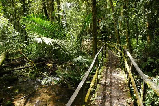
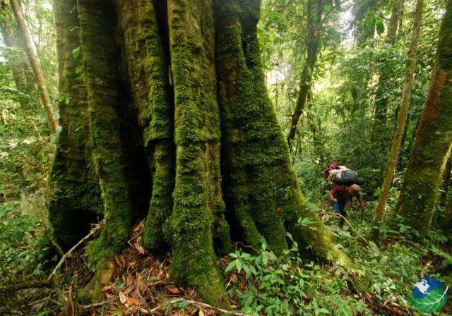
Gigantes del Bosque Trail: In a journey of almost 2 km’s you will see areas in regeneration, secondary forests and primary forest, where different species of trees inhabit, among which the sweet cedar and the pink anger stand out, some of which exceed thirty meters; It is an excellent path for bird watching, where there are also some species of mammals such as dasiproctas, coatis, capuchin monkeys, and spider monkeys.
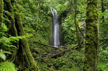
La Cascada (The Waterfall): After walking almost 2 km, you will reach three adjacent waterfalls; along the trail, you will enjoy lots of birds flying in a premontane forest and open areas.
Canasta River: A continuous flow of clean and crystalline waters that come from the bowels of the cloud forest of Pittier Hill; to get to the site, you must pass through Santa María de Pittier (Coto Brus de Puntarenas) and walk a 4-kilometer path, during which you can find traces of mammals such as Dantas, jaguars, pumas, mountain goats, spiders, and capuchin monkeys, a large number of birds, including the goldfinch and the bellbird.
Getting there.
To access La Amistad International Park there are different ways; By car, getting to Buenos Aires from Puntarenas or San Vito and then taking a rural taxi to any of the park entrances:
In the Tres Colinas sector (Cerro Kámuk) there is a 2-hour stretch from Buenos Aires, following the route to San Vito and turning off at Paso Real; from there you take the detour to the community of Potrero Grande, located 6 km from the site, and then the road to Tres Colinas, which is located at a distance of 23 km. The trip must be done in a double traction vehicle.
Biolley (Valle del Silencio, Sabanas Esperanza) is reached from Pérez Zeledón after a three-hour ride, taking the route along the South Inter-American Road until it deviates at kilometer 221 in the place known as Paso Real. From there you travel 15 km to San Vito until you reach the community of Las Tablas de Potrero Grande; on this site, you take another detour and continue along a rustic road for 20 km; This route is passable all year round by double traction vehicles, and during the dry season by cars and minibus.
The recommended route to reach the Santa María sector (Cerro Cabécar) is the San Isidro de Pérez Zeledón South American Road towards Buenos Aires, until reaching the town of Santa Marta de Brunka, located one kilometer 184; Subsequently, there is a detour to the north, which path is ballast, until reaching the community of Santa María, located 15 km from Santa Marta. Access can be made by double-traction vehicles all year.
Access Hours:
Every day from 8:00 is to 4:00 pm.
For reservations, during this same period.
Services available to visitors from the Parks administration:
Drinking water
Electricity at Altamira Biological Station and Pittier Operating Position
Lunch Areas
Sanitary services
Short walking trails (2 km)
Long hiking trails (14 km to 26 km)
Hill Lookout viewpoints
Parking lot
Specialized local tour guides
Some services such as lodging, food stores, transport of materials and luggage storage can be hired in the surrounding communities, directly with the organized community groups: La Amistad Producers Association, Biolley Women Association, Santa María de Brunka Ecological Chamber Association and Association of Tres Colinas Tourism.
Recommendations:
• Respect the regulations for public use of La Amistad International Park.
• All provisions and regulations of park rangers are mandatory. In case of any irregular event, go to the SINAC-Pila officials.
• Respect the park visiting hours (8:00 am – 4:00 pm)
• Take care of your belongings.
• Stay on the trails.
• Bathing in the waterfalls or rivers is not allowed.
• Do not carry any type of drugs or narcotics.
• No smoking allowed.
• Do not carry weapons of any kind.
• Do not feed the animals.
• Properly deposit waste in the disposal sites.
• Entry with pets is not allowed.
• Do not extract plants, rocks, animals, archaeological pieces and any other derived from biodiversity and natural resources.
• It is not allowed to perform sports activities, noise or other actions that alter public order and the resources of the protected area
• Fires are not allowed.
• Food consumption is allowed only in the places established by the park.

