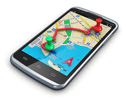
The world is advancing at a rate where the demands on the subject of innovations are advancing at a rapid pace.
Precisely the Global Positioning System or GPS locator (for its acronym in English) has had a wide scope and its implementation has had a use that ranges from vehicles to people or pets. This works through a network of approximately 24 satellites that rotate over the earth and synchronize a path to locate a certain point or object.
If you want to learn more on GPS tools, you can read about batch geocode.
Advantages of using GPS
The advantages of implementing a GPS vary according to the purpose; however, some of its benefits are worth noting.
Optimizes security: In an emergency or simply out of necessity, this type of system makes it easier to locate a vehicle, a fleet, a person, or a pet.
Avoid theft: This type of technology has been implemented to prevent theft of merchandise, for example, many companies monitor their fleets when they make a long journey, the intention is to track them, corroborate the route and verify some kind of anomaly.
It allows reducing costs: Knowing and managing the routes allows you to have some control in the event of a robbery; the reason why the GPS locator will be of great help to avoid having to resort to processes that imply additional costs, including a high amount of reward.
How a GPS works
The global positioning system allows the position of an object, be it a thing, a vehicle, a person, to be determined, all over the world, with a precision of centimeters in some cases. However, for civil applications, the accuracy is metered.
It was born as a military application in the United States, developed by the Defense Department of that country. The GPS works thanks to 24 satellites that know the position of an object by triangulation, that is, it uses more than one satellite to locate the position of an object, in fact, at least three of them.

The network of 24 satellites rotates in orbit over the earth, at a distance of 20,200 km in height, with synchronized trajectories that cover the entire surface of the planet.
When you need to know the position of an object, three minimum satellites are used, which receive the signal that identifies it, as well as the time, from the cell phone or the GPS device. With these signals, the system then calculates the time it takes for the signals to arrive and thus knows the position of the object.
However, this is not enough for an application like the one we use on the phone to work. It is necessary to have fed the maps of the cities, of the streets, to be able to provide the pertinent information. In other words, a GPS application recognizes the position in latitude and longitude and makes its equivalent concerning a map that knows the names of streets, avenues, shops, places of interest, etc.
Vehicle safety
Systems that support vehicle safety are increasingly being implemented as they secure business assets and minimize risks from them. This type of solutions allows remote monitoring of fleets thanks to ioT, among its benefits are:
Efficiency in operation: Vehicle management supplies many important data to show failures, downtime, and even identify opportunities for improvement in the routes or forms of execution.
Minimization of maintenance costs: With the implementation of this type of technology it is possible to improve the safety of vehicles in terms of their maintenance and proper use.
Immediate response: By monitoring the routes with the implementation of the GPS locator it is possible to act immediately against theft or accidents.
Reduction of environmental pollution: Sustainable solutions are an increasingly critical issue for companies, through vehicle management, it is possible to be aware of compliance with environmental regulations required by law.
The appearance of GPS represents a security tool for things, objects, and people. GPS came to favor our ways of life.

