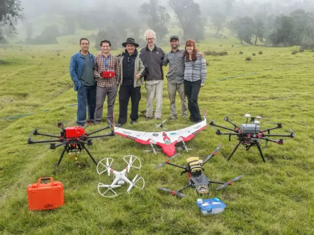
The companies Intel Costa Rica, Aerial Robotixs and the Foundation for the Development of the Central Volcanic Mountain Range (Fundecor), presented a project that would quantify, on a large scale, carbon capture, biomass, and even the health of tropical forests.
This is “Deep Forest”, an initiative that combines drones with ample flight capacity and coverage, with Intel technology for data processing and scientific knowledge in the measurement of these vital indicators for the health of forests and the planet.
The “Deep Forest” project brings together science and technology to quantify the capture of carbon, biomass and the health of tropical forests, which will give them greater economic value, knowing how much carbon dioxide (CO2) emitted into the atmosphere could be ” kidnapped “in the forests and, thereby, reduce greenhouse gases.
Now for the first time, a fixed-wing drone will use a direct measurement system consisting of a high-definition laser scanner (LiDAR HD) and a multispectral camera, instruments that will determine and provide, among other things, a 3-D model of the surface of the forest, canopy cover, relevant information on the health of trees, height, biomass, number of trees, among the most important parameters.

“The LIDAR HD technology airborne in a drone allows the capture of a geo-referenced point cloud which serves for the 3-D modeling of the forest. The LiDAR HD is the only scientific instrument that has the ability to penetrate the forest canopy and obtain information across all strata and reach the understory and the ground”, explains Nelson Mattie, founder, and CEO of Aerial Robotixs.
The potential use of this tool is broad. “Knowing robust information, large-scale and with an acceptable level of precision could have profound implications for scientific study, management policies, conservation and monitoring of forests and plantations, among many other uses”, says Felipe Carazo, CEO of Fundecor.
“This work with Aerial Robotixs and Fundecor, to enable Intel technology in a fixed-wing drone, with a sophisticated measurement system that could have an impact worldwide, is extremely important for us and is an example of those alliances we are making in Intel Costa Rica to jointly develop innovative and highly relevant projects that could help solve global problems”, said Timothy Scott, Manager of Government Affairs and Public Relations at Intel Costa Rica.
Innovation
The project has some outstanding innovations. On the one hand, it is the first time that a LiDAR HD equipment is operated in tropical forests in a drone unit, to make estimates of carbon stock.
The challenges are great when operating this type of system in remote areas, in areas with air traffic and complex topography. In addition, data processing involves the development of software and allometric equations to convert LiDAR HD point clouds into estimates of biomass and carbon in stock.
The final product of this project is data that allow decisions to be made at an operational, managerial and administrative level with reliable information, in addition to being an instrument for tracking and tracing carbon transactions. That is useful information for the most diverse uses.
The next level
The calculations of biomass and more recently of carbon capture were made by different methodologies.
In the first place, the measurement was carried out “in situ” and directly on a part of the forest mass. Recently, the use of indirect measurements with optical-electronic sensors was added, which perform the calculations at the canopy level.
The use of LIDAR HD in unmanned vehicles and the interpretation of data through resources designed for tropical forests is the next level.

