For nobody is a secret that Costa Rica constantly suffers from earthquakes and tremors, which is due to “Sub-duction Zones” where large tectonic plates interact. These are, specifically, the Coco, Caribbean, Nazca, and the South American Plates. Japan, Mexico, Peru, and Chile are other countries where the situation is the same. In Costa Rica, it must be taken into account that there are higher seismicity periods than others.
For the seismologist of the Volcanological and Seismological Observatory of Costa Rica (Ovsicori) of the National University (UNA), Marino Protti, the Central American country must always be prepared to face every seismological activity, because it is never known when a very strong movement can occur.

According to information from the National Seismological Network (RSN), Costa Rica has 2 peninsulas that are registered in that zone of accumulation and release of energy, which generate earthquakes. Their contact areas between plates are identified: Nicoya is capable of generating earthquakes of a maximum magnitude of 7.9; Osa and Burica, 7.4; and the Southern Caribbean, of 7.6.
Earthquakes of great magnitude in Costa Rica
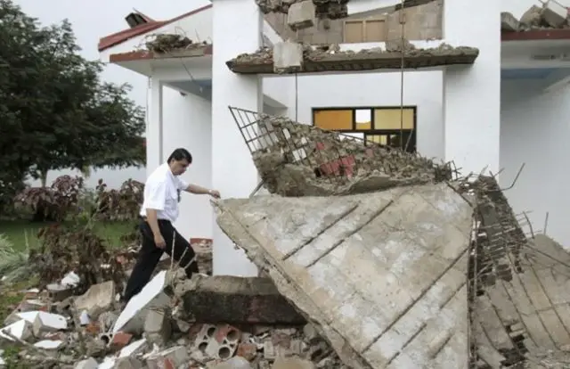
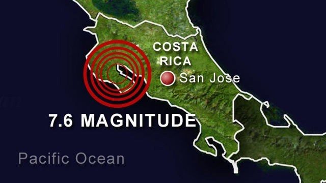
Costa Rica is a country very much blessed by nature; not only does it have incredible biodiversity, but also it has had several major earthquakes that have made worldwide headlines, like the one that occurred on September 5th, 2012 in Guanacaste (magnitude 7.6), other transcendental and slightly lower earthquakes were the Golfito in 1983 (magnitude 7.4), Cóbano in 1990 (magnitude 7.0), and Limón in 1991 (magnitude 7.7).
It is worth noting that the seismologist Marino Protti was one of the researchers who launched a seismological monitoring program, which has been in place for more than 20 years. Protti in company with another specialist, Víctor González, anticipated the Nicoya earthquake, which occurred on September 5th, 2012.
Since 1995, the Ovsicori’s seismologists have been able to observe how the “faults” have been loaded, which parts are stronger and which are weaker. It is important to mention that the earthquake of 2012 was preceded by a “slow earthquake” that instruments began to register weeks before the great earthquake.

Protti has explained on certain occasions, the contribution that slow earthquakes have in reducing the energetic potential of future destructive earthquakes. “If slow earthquakes did not occur, all the deformation would accumulate to be released in earthquakes much greater than those that actually occur”. This renowned seismologist says it is worth knowing, in advance, where earthquakes will occur. If the population can be prevented and prepared, then science pays the bill for the investment made in it.
The National Seismological Network has a fundamental role
As part of an institutional collaboration program for seismological observation in Costa Rica, the National Seismological Network (RSN) was created in 1982. In its beginnings, it constituted a joint effort by the Department of Geology (ICE), the volcanological research program of the School of Geography of the National University (UNA) and the Section of Seismology, Volcanology and Geophysical Exploration of the Central American School of Geology (UCR) that participated with the Network.
Currently, only the ICE and UCR constitute it; the ICE Seismic and Volcanic Threat and Auscultation Area and the Seismology Section. Volcanology and Geophysical Exploration of the Central American School of Geology (UCR) maintain a joint effort that integrates personnel, equipment, and information. Since 1976, and until now, the National Seismological Network shares the monthly bulletin of registered earthquakes and volcanic activity.
Recent seismic activities
Can you believe that from October 31st until November 18th, of the current year, approximately 50 seismological activities have been recorded? It is something true that one of the earthquakes that have had greater magnitude, until now, has been Saturday, November 17th, with a 5.1 magnitude, at 8:12 am.
The report presented by the Ovsicori, highlighted that the earthquake had an epicenter 14.6 kilometers Southwest of Guápiles, Pococí, in the Caribbean province of Limón, with a depth of 10 kilometers, which could be perceived in diverse Costa Rican communities such as Pococí, San Isidro and Santo Domingo de Heredia, Coronado, Moravia, Tibás, and Goicoechea. The origin of the earthquake was due to the Caribbean plate fault (local or superficial).
The earthquake on Sunday, November 18th, was at 3:47 pm with a 3.7 magnitude and a location of 9 kilometers Northeast of Puerto Jiménez, Golfito. There have been innumerable seismological events, all registered by the specialized institutions in the area. We will continue to report on all of them and the work that the RED is carrying out.

